
Lord Howe Island (play /ˈhaʊ/, locally /ˈhæɔ/) is an irregularly crescent-shaped volcanic remnant in the Tasman Sea between Australia and New Zealand, 600 kilometres (370 mi) directly east of mainland Port Macquarie, and about 900 kilometres (560 mi) from Norfolk Island. The island is about 10 km long and between 2.0 km and 0.3 km wide with an area of 14.55 km2, "of which only 398 hectares is in the lowland settled area". Along the west coast there is a sandy semi-enclosed sheltered coral reef lagoon.
Most of the population lives in the north, while the south is dominated by forested hills rising to the highest point on the island, Mount Gower (875 m or 2,871 ft). The Lord Howe Island Group of islands comprises 28 islands, islets and rocks. Apart from Lord Howe Island itself the most notable of these is the volcanic and uninhabited Balls Pyramid about 23 km to the south-east. To the north there is the Admiralty Group, a cluster of seven small uninhabited islands.The first reported sighting of Lord Howe Island was on 17 February 1788 when Lieutenant Henry Lidgbird Ball, commander of the Armed Tender HMS Supply was on its way from Botany Bay to found a penal settlement on Norfolk Island. On the return journey Ball sent a party ashore on Lord Howe Island to claim it as a British possession. It subsequently became a provisioning port for the whaling industry, and was permanently settled in June 1834. When whaling declined, the worldwide export of the endemic kentia palms began in the 1880s, which remains a key component of the Island's economy. The other continuing industry, tourism, began after World War II.
The Lord Howe Island Group is part of the state of New South Wales that, for legal purposes, is regarded as an unincorporated area administered by the Lord Howe Island Board which reports to the New South Wales Minister for Climate Change, Environment and Water. The island's standard time zone is UTC+10:30, or UTC+11 when daylight saving time applies. The currency is the Australian dollar. Commuter airlines are linked to Sydney, Brisbane, Port Macquarie and Norfolk Island.

The Lord Howe Island Group is recorded by UNESCO as a World Heritage Site of global natural significance. Most of the island is virtually untouched forest with many of the plants and animals found nowhere else in the world. Other natural attractions include the diversity of its landscapes, the variety of upper mantle and oceanic basalts, the world's southernmost barrier coral reef, nesting seabirds, and its rich historical and cultural heritage. The Lord Howe Island Act of 1981 established a "Permanent Park Preserve" (covering approximately 70 per cent of the island). The surrounding waters are a protected region designated the Lord Howe Island Marine Park.
History
788–1834 First European visits

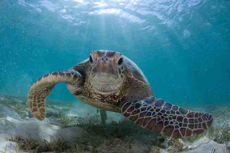
It appears that, prior to European discovery and settlement, Lord Howe Island was uninhabited, and unknown to Polynesian peoples of the South Pacific.[19] The first reported European sighting of Lord Howe Island was on 17 February 1788 when Lieutenant Henry Lidgbird Ball, commander of the Armed Tender HMS Supply (the oldest and smallest of the First Fleet ships) was on its way from Botany Bay with a cargo of 15 convicts (9 male, 6 female) to found a penal settlement on Norfolk Island. On the return journey of 13 March 1788 Ball observed Ball's Pyramid and sent a party ashore on Lord Howe Island to claim it as a British possession.Numerous turtles and tame birds were captured and returned to Sydney. Ball named Mount Lidgbird and Balls Pyramid after himself and the main island after Richard Howe, First Earl Howe, who was First Lord of the Admiralty at the time.
Original drawing of the extinct White Gallinule by Arthur Bowes Smyth, surgeon aboard First Fleet ship HMS Lady Penrhyn
The extinct White Gallinule (Porphyrio albus).
A drawing made in May 1788 by Arthur Bowes Smyth who was the surgeon aboard HMS Lady Penrhyn, a ship of the First Fleet heading for China on its return trip to England

Many names on the island date from this time, and also from May of the same year when the island was visited by four ships of the First Fleet, HMS Supply, Charlotte, Lady Penrhyn and Scarborough when much of the plant and animal life was first recorded in the journals and diaries of visitors like David Blackburn, Master of the Supply. Watercolour sketches of native birds including the Lord Howe Woodhen (Gallirallus sylvestris), White Gallinule (Porphyrio albus), and Lord Howe Pigeon (Columba vitiensis godmanae), were made by artists including George Raper and John Hunter. As the latter two birds were soon hunted to extinction these paintings are their only remaining pictorial record. Over the next three years the Supply returned to the island several times in search of turtles and the island was also visited by ships of the Second and Third Fleets. Between 1789 and 1791 the Pacific whale industry was born with British and American whaling ships chasing Sperm Whales (Physeter macrocephalus) along the equator to the Gilbert and Ellice archipelago, then south into Australian and New Zealand waters. The American fleet numbered 675 ships and Lord Howe was located in a region known as the 'Middle Ground' noted for Sperm Whales and Southern Right Whales (Eubalaena australis).
The island was subsequently visited by many government and whaling ships sailing between New South Wales and Norfolk Island and across the Pacific, including many from the American whaling fleet, so its reputation as a provisioning port preceded settlement, some ships leaving goats and pigs on the island as food for future visitors. Between July and October 1791 the Third Fleet ships arrived at Sydney and within days the deckwork was being reconstructed for a future in the lucrative whaling industry. Whale oil was to become New Holland's (Australia) most profitable export until the 1830s, and it was the whaling industry that shaped Lord Howe Island's early history.
1834–1841 Settlement

Permanent settlement on Lord Howe was established in June 1834 when the British whaling barque Caroline, sailing from New Zealand and commanded by Captain John Blinkenthorpe, landed at what is now known as Blinky Beach. They left three men, George Ashdown, James Bishop and (unknown) Chapman, who were employed by a Sydney whaling firm to establish a supply station. The men were initially to provide meat by fishing and by raising pigs and goats from feral stock. They landed with (or acquired from a visiting ship) their Maori wives and two Maori boys. Huts were built in an area now known as Old Settlement which had a supply of fresh water, and a garden was established west of Blinky Beach.
This was a cashless society; the settlers bartered their stores of water, wood, vegetables, meat, fish and bird feathers for clothes, tea, sugar, tools, tobacco and other commodities not available on the island — but it was the whalers’ valuation that had to be accepted. These first settlers eventually left the island when they were bought out for £350 in September 1841 by businessmen Owen Poole and Richard Dawson (later joined by John Foulis) whose employees and others now settled on the island.
1842–1860 Trading provisions

The new business was advertised and ships now trading between Sydney and the New Hebrides (Vanuatu) would also put in to the island. Rover's Bride, a small cutter, became the first regular trading vessel. Between 1839 and 1859 between five and twelve ships made landfall each year, occasionally closer to 20 with seven or eight at a time laying off the reef. In 1842 and 1844 the first children were born on the island. Then in 1847 Poole, Dawson and Foulis, bitter at failing to obtain a land lease from the New South Wales Government, abandoned the settlement although three of their employees remained. One family, the Andrews, after finding some onions on the beach in 1848, cultivated them as the 'Lord Howe Red Onion' which was popular in the southern hemisphere for about 30 years until the crop was attacked by smut disease.
Etching of HMS Herald from the London Illustrated News with the steamship Torch in the background
'Expedition to the South Seas'HMS Herald & steamship tender TorchIllustrated London News May 15, 1852
In 1849 there were just 11 people living on the island but it was not long before the island farms expanded. In the 1850s gold was discovered on mainland Australia where crews would abandon their ships, preferring to dig for gold than to risk a life at sea. As a consequence many vessels avoided the mainland and Lord Howe Island experienced an increasing trade which peaked between 1855 and 1857. In 1851 about 16 people were living on the island. Between 1839 and 1859 between five and twelve ships made landfall per year (occasionally closer to 20) with seven or eight at a time laying off the reef. Vegetable crops now included potatoes, carrots, maize, pumpkin, taro, watermelon — even grapes, passionfruit and coffee. Between 1851 and 1853 there were several aborted proposals by the NSW Government to establish a penal settlement on the island.
From 1851 to 1854 Henry Denham captain of HMS Herald, which was on a scientific expedition to the southwest Pacific (1852–1856), completed the island's first hydrographic survey. On board were three Scottish biologists, William Milne (a gardener-botanist from the Edinburgh Botanic Garden), John Macgillivray (naturalist) who collected fish and plant specimens, and Assistant Surgeon and zoologist Denis Macdonald. Together these men established much basic information on the geology, flora and fauna of the island.
In about 1853 a further three settlers arrived on the American whaling barque Belle, captained by Ichabod Handy. As well as George Campbell (who died in 1856) and Jack Brian (who left the island in 1854), the third, Nathan Thompson, brought three women (called Botanga, Bogoroo, and a girl named Bogue) from the Gilbert Islands. When his first wife Botanga died he then married Bogue. Thompson was the first resident to build a substantial house in the 1860s from mainland cedar washed up on the beach. Most of the residents with island ancestors have blood relations or are connected by marriage to Thompson and his second wife Bogue.
In 1855 the island was officially designated as part of New South Wales by the Constitution Act.
1861–1890 Scientific expeditions
From the early 1860s whaling declined rapidly with the increasing use of petroleum, the onset of the Californian goldrush, and the American Civil War — with unfortunate consequences for the island. To explore alternative means of income Thompson, in 1867, purchased the Sylph which was the first local vessel to trade with Sydney (mainly pigs and onions). It anchored in deep water at what is now Sylph’s Hole off Old Settlement Beach, but was eventually tragically lost at sea in 1873 which added to the woes of the island at this time.
In 1869 the island was visited by a magistrate P. Cloete aboard the Thetis investigating a possible murder. He was accompanied by Charles Moore, Director of the Botanic Gardens, Sydney and his assistant, William Carron who forwarded plant specimens to Ferdinand Mueller at the botanic gardens in Melbourne who, by 1875, had catalogued and published 195 species. Also on the ship was William Fitzgerald a surveyor and Mr Masters from the Australian Museum. Together they surveyed the island with the findings published in 1870 when the population was listed as 35 people, their 13 houses built of split palm battens thatched on the roof and sides with palm leaves. At about this time there began a downturn of trade with the demise of the whaling industry and sometimes six or twelve months passed without a vessel calling. With the provisions rotting in the storehouses the older families lost interest in market gardening.
From 1860 to 1872 forty-three ships had collected provisions, but from 1873 to 1887 there were fewer than a dozen. This prompted some activity from the mainland. A 1876 a government report on the island was submitted by surveyor William Fitzgerald based on a visit in the same year. He suggested that coffee be grown but the kentia palm was already catching world attention. In 1878 the island was declared a Forest Reserve and Captain Richard Armstrong became the first resident government administrator. He encouraged schools, tree-planting and the palm trade, dynamited the north passage to the lagoon, and built roads but, having managed to upset the residents, parliamentarian John Wilson was sent from the mainland in April 1882 to investigate the situation. With Wilson was a team of scientists that included H. Wilkinson from the Mines Department, W. Condor from the Survey Department, J. Duff from the Sydney Botanical Gardens and A. Morton from the Australian Museum. J. Sharkey from the Government Printing Office took the earliest known photographs of the Island and its residents. A full account of the island appeared in the report from this visit published as "Lord Howe Island 1882", which also recommended that Armstrong be replaced. Meanwhile the population had increased considerably and included 29 children; the report recommended that a schoolmaster be appointed.This study sealed a lasting relationship with three scientific organisations, the Australian Museum, Sydney Royal Botanic Gardens and Kew Royal Botanic Gardens.
1890–present

In 1883 the company Burns Philp started a regular shipping service and the number of tourists gradually increased. By 1932, with the regular tourist run of the SS Morinda, tourism became the second biggest source of external income after palm sales to Europe. Morinda was replaced by Makambo in 1932, and she in turn by other vessels. The service continues into the present day with the fortnightly Island Trader service from Port Macquarie.
The palm trade began in the 1880s when the lowland Kentia Palm (Howea forsteriana) was first exported to Britain, Europe and America but the trade was only placed on a firm financial footing when the Lord Howe Island Kentia Palm Nursery was formed in 1906 (see below).
The first plane to appear on the island was in 1931 when Francis Chichester alighted on the lagoon in a Gipsy Moth converted into a floatplane. It was damaged here in an overnight storm but repaired with the assistance of islanders and then took off successfully nine weeks later for a flight to Sydney. After World War II, in 1947, tourists arrived on Catalina and then Sandringham flying boats operating out of Rose Bay, Sydney, and landing on the lagoon, the journey taking about 3.5 hours. These seaplanes were replaced by twin-engined aircraft (in 2011 Dash 8 turbo-props) when the Lord Howe Island Airport was completed in 1974. In 2002, the Royal Navy destroyer HMS Nottingham struck Wolf Rock, a reef at Lord Howe Island, and almost sank. In recent times tourism has increased and the government of New South Wales has been increasingly involved with issues of conservation.
On 17 October, 2011, a supply ship, M/V Island Trader with twenty tons of fuel ran aground in the lagoon. The ship refloated at high tide with no loss of crew or cargo.
Demographics
For the 2006 census, the resident population was 348 people and the number of tourists was not allowed to exceed 400. Early settlers were European and American whalers and many of their offspring have remained on the island for more than six generations. Residents are now involved with the Kentia Palm industry, tourism, retail, some fishing and farming. In 1876 it was observed that on Sundays although there was a suspension of games and labour, there were no religious services. Nowadays, in an area known locally as 'Church Paddock', there are Anglican, Catholic and Adventist churches, the religious affiliations on the island being 30% Anglican, 22% no religion, 18% Catholic and 12% Seventh Day Adventist. There is an approximately equal division of the sexes with 47% of the population in the age group 25–54 and 92% holding Australian citizenship.
Governance and land tenure
Official control of Lord Howe Island lay initially with the British Crown until it passed to New South Wales in 1855, although until at least 1876 the islanders lived in "a relatively harmonious and self-regulating community". In 1878 Richard Armstrong was appointed administrator when the NSW Parliament declared the island a Forest Reserve. But as a result of ill feeling, and an enquiry, he was eventually removed from office on 31 May 1882 (he returned later that year though to view the transit of Venus from present-day Transit Hill). After his removal the island was administered by four successive magistrates until 1913 when a Sydney-based Board was formed until 1948 when a resident superintendent was appointed. In 1913 the three-man Lord Howe Island Board of Control was established, mostly to regulate the palm seed industry, but also administering the affairs of the island from Sydney until the present Lord Howe Island Board was set up in 1954.
The Lord Howe Island Board is a NSW Statutory Authority established under the Lord Howe Island Act, 1953, to administer the island as part of the state of New South Wales. It reports directly to the state's Minister for Climate Change, Environment and Water, and is responsible for the care, control and management of the island. Its duties include: the protection of World Heritage values; the control of development; the administration of Crown Land, including the island's protected area; provision of community services and infrastructure; and regulating sustainable tourism. In 1981 the Lord Howe Island Amendment Act gave islanders the administrative power of three members on a five-member Board. The Board also manages the Lord Howe Island Kentia Palm Nursery which, together with tourism, provides the island's only sources of external income. Under an amendment bill in 2004 the Board now comprises seven members, four of whom are elected from the islander community, thus giving the approximately 350 permanent residents a high level of autonomy. The remaining three members are appointed by the Minister to represent the interests of business, tourism and conservation. The full Board meets on the island every three months while the day-to-day affairs of the island are managed by the Board's administration, with a permanent staff that had increased to 22 people by 1988.
Land tenure has been an issue since first settlement as island residents repeatedly requested freehold title or an absolute gift of cultivated land. Original settlers were squatters. The granting of a 100-acre (40 ha) lease to Richard Armstrong in 1878 drew complaints and a few short-term leases (Permissive Occupancies) were granted. In 1913, with the appointment of a Board of Control, permissive occupancies were revoked and the Board itself given permissive occupancy of the island. Then the Lord Howe Island Act of 1953 made all land the property of the Crown. Direct descendants of islanders with permissive occupancies in 1913 were granted perpetual leases on blocks of up to 5 acres (2.0 ha) for residential purposes. Short-term special leases were granted for larger areas used for agriculture, so in 1955, 55 perpetual leases and 43 special leases were granted. The 1981 amendment to the act extended political and land rights to all residents of 10 years or more. There remains an active debate concerning the proportion of residents with tenure and the degree of influence on the Board of resident islanders in relation to long-term planning for visitors, and issues relating to the environment, amenity and global heritage.
Economy
Trading vegetables, meat, fish and other perishables with visiting ships ceased in the 1870s when the whaling industry collapsed. With such a small population the economy is now extremely simple with external income derived from only two significant sources, the overseas sale of Kentia palm seeds and seedlings, and tourism.
Kentia palm industry
The first exporter of palm seeds was Ned King, a mountain guide for the Fitzgerald surveys of 1869 and 1876, who sent seed to the Sydney Botanic Gardens. Overseas trade began in the 1880s when it was found that one of the four palms endemic to the island, Kentia Palm (Howea forsteriana), which grows naturally in the lowlands, was ideally suited to the fashionable conservatories of the well-to-do in Britain, Europe and the United States, but the assistance of mainland magistrate Frank Farnell was needed to put the business on a sound commercial footing when in 1906 he became Director of a company, the Lord Howe Island Kentia Palm Nursery, whose shareholders included 21 islanders and a Sydney-based seed company. However, the formation of the Lord Howe Island Board of Control was needed in 1913 to resolve outstanding issues.
The native Kentia Palm (known locally as the Thatch Palm as it was used to thatch the houses of the early settlers) is now the most popular decorative palm in the world. The mild climate of the island has evolved a palm which can tolerate low light, a dry atmosphere and lowish temperatures – ideal for indoor conditions. Up to the 1980s the palms were only sold as seed but from then onwards only as high quality seedlings. The nursery received certification in 1997 for its high quality management complying with the requirements of Australian Standard AS/NZS 150 9002.
Seed is gathered from natural forest and plantations, most collectors being descendants of the original settlers. Seed is then germinated in soil-less media and sealed from the atmosphere to prevent contamination. After testing they are picked, washed (bare-rooted), sanitised and certified then packed in sealed in insulated containers for export. They grow both indoors and out and are popular for hotels and motels world-wide. Nursery profits are returned to enhance the island ecosystem. The nursery plans to expand the business to include the Curly Palm and other native plants of special interest.
Tourism

To relieve pressure on the small island environment only 400 tourists are permitted at any one time.The island is reached by plane from Sydney or Brisbane in less than two hours. The Permanent Park Preserve declared in 1981 has similar management guidelines to a National Park.

Facilities
With fewer than 800 people on the island at any time, facilities are limited; they include a bakery, butcher, general store, liquor store, restaurants, post office, museum and information centre, a police officer, a ranger and an ATM at the bowling club. Stores are shipped to the island fortnightly by the Island Trader from Port Macquarie. There is a small four-bed hospital and dispensary. A small botanic garden displays labelled local plants in its grounds. Diesel-generated power is 240 V AC, as on the mainland. There is no public transport nor mobile phone coverage, but there are public telephones, fax facilities and internet access as well as a local radio station and newsletter, The Signal.
Tourist accommodation ranges from luxury lodges to apartments and villa units. The currency is Australian dollars and there are two banks. There are no camping facilities on the island and remote-area camping is not permitted. To protect the fragile environment of Balls Pyramid (which carries the endangered Lord Howe Island phasmid) recreational climbing there is prohibited. No pets are allowed without permission from the Board. Islanders use tanked rainwater, supplemented by bore water for showers and washing clothes.
Activities
As distances to sites of interest are short, cycling is the main means of transport on the island. Tourist activities include golf (9-hole), lawn bowls, tennis, fishing (including deep-sea game fishing), yachting, windsurfing, kite surfing, kayaking, and boat trips (including glass-bottom tours of the lagoon). Swimming, snorkelling and scuba diving are also popular in the lagoon, as well as off Tenth of June Island, a small rocky outcrop in the Admiralty group where an underwater plateau drops 36 metres to reveal extensive gorgonia and black corals growing on the vertical walls. Other diving sites are found off Balls Pyramid, 26 km away, where there are trenches, caves and volcanic drop-offs.
Bushwalking, natural history tours, talks, and guided walks take place along the many tracks, the most challenging being the eight-hour guided hike to the top of Mount Gower. There are 11 beaches and hand-feeding the metre-long Kingfish (Rexea solandri) and large wrasse at Ned's Beach is very popular. Walking tracks cover the island with difficulty graded from 1-5, they include – in the north: Transit Hill 2 hours return, 2 km; Clear Place, 1–2 hours return; Stevens Reserve; North Bay, 4 hours return, 4 km; Mt Eliza; Old Gulch, 20 minutes return, 300 m; Malabar Hill and Kims Lookout, 3 hours, or 5 hours return, 7 km and – in the south: Goat House Cave, 5 hours return, 6 km; Mount Gower, 8 hours return, 14 km; Rocky Run and Boat Harbour; Intermediate Hill, 45 minutes return, 1 km; Little Island, 40 minutes return, 3 km. Recreational climbers must obtain permission from the Lord Howe Island Board.
Geography

Lord Howe Island is an irregularly crescent-shaped volcanic remnant in the southwest Pacific Ocean. Lying in the Tasman Sea between Australia and New Zealand the island is 600 kilometres (370 mi) east of mainland Port Macquarie, 702 kilometres (436 mi) northeast of Sydney, and about 772 kilometres (480 mi) from Norfolk Island to its northeast. The island is about 10 km long and between 2.0 km and 0.3 km wide with an area of 14.55 km2. Along the west coast there is a semi-enclosed sheltered coral reef lagoon with white sand, the most accessible of the island's eleven beaches. Both the north and south sections of the island are high ground of relatively untouched forest, in the south comprising two volcanic mountains, Mount Lidgbird (777 m or 2,549 ft) and Mount Gower which, rising to 875 m (2,871 ft), is the highest point on the island.[81] In the north, where most of the population live, high points are Malabar (209 m or 686 ft) and Mount Eliza (147 m or 482 ft). Between these two uplands is an area of cleared lowland with some farming, the airstrip, and housing. The Lord Howe Island Group of islands comprises 28 islands, islets and rocks. Apart from Lord Howe Island itself the most notable of these is the pointed rocky islet Balls Pyramid, a 551-metre-high (1,808 ft) eroded volcano about 23 km to the south-east, which is uninhabited but bird-colonised. To the north there is the Admiralty Group, a cluster of seven small uninhabited islands. Just off the east coast is Mutton Bird Island, and in the lagoon is Blackburn (Rabbit) Island.
Geological origins
Lord Howe Island is the highly eroded remains of a 7 million-year-old shield volcano, the product of eruptions that lasted for about a half-million years. It is one of a chain of islands that occur on the western rim of an undersea shelf, the Lord Howe Rise, which is 3000 km long and 300 km wide extending from New Zealand to the west of New Caledonia and consisting of continental rocks that separated from the Australian plate 60 to 80 million years ago to form a new crust in the deep Tasman Basin.[84] The shelf is part of Zealandia, a microcontinent nearly half the size of Australia that gradually submerged after breaking away from the Gondwanan supercontinent. The Lord Howe seamount chain is defined by coral-capped guyots stretching to the north of the island for 1000 km (600 mi) and including the Middleton 220 kilometres (140 mi) and Elizabeth (160 kilometres (99 mi) away) reefs of the Elizabeth and Middleton Reefs Marine National Park Reserve. This chain of nine volcanic peaks was probably produced by the northward movement of the Indo-Australian Plate over a stationary hotspot so the oldest guyots were the first formed and most northerly as the plate moved northward at a rate of 6 cm per year (see plate tectonics).
Basalts and calcarenite

Two periods of volcanic activity produced the major features of the island. The first about 6.9 million years ago produced the northern and central hills while the younger and highly eroded Mt Gower and Mt Lidgbird were produced about 6.3 million years ago by successive basalt (an extrusive igneous rock) lava flows that once filled a large volcanic caldera (crater)[88] and can now be seen as horizontal basalt strata on mountain cliffs (at Malabar and Mt Gower) occasionally interspersed with dikes (vertical lava intrusions). Geological pyroclastic remnants of volcanic eruption can be seen on Roach Island (where the oldest rocks occur) and Boat Harbour as tuff (ash), breccia (with angular blocks), and agglomerate (rounded 'bombs'). Offshore on the Lord Howe Rise water depths reach 2000 m falling to 4000 m to the west of the rise. From the dimensions of the rock on which the island stands it has been calculated that the island has eroded to one fortieth of its original size.
Rocks and land at the foot of these mountains is calcarenite, a coral sand, blown inland during the Pleistocene between 130,000 and 20,000 years ago and cemented into stratified layers by water percolation. In this rock are fossils of bird bones and eggs, land and marine snails and the extinct endemic Horned Turtle (Meiolania platyceps) now thought to be an ancient relictual non-swimming tortoise with relatives in South America. The crescent of the island protects a coral reef and lagoon, the barrier reef, at 31° S, is the most southerly in the world. Beach sands, rather than consisting of quartz grains derived from granite, as on the mainland, are made of fragments of shell, coral and coralline algae, together with basalt grains, and basaltic minerals like black diopside, and green olivine. The lowland consists of alluvial soils.
The island continues to erode rapidly and is expected to be fully submerged within 200,000 years taking an appearance akin to the Middleton and Elizabeth Reefs.
Climate

Lord Howe Island has a subtropical climate. In general the summers are mild or warm with rainfall erratic but occasionally heavy while in winter it is cool with rainfall more or less uniform. There is a gradual transition from summer to winter conditions and vice versa. Winds are frequent and salt-laden being moderate easterlies in the summer and fresh to strong westerlies in the winter. July is the windiest month, and the winter months are subject to frequent gales and strong winds. Storm events and occasional cyclonic activity also affect the island. Rainfall records are maintained in the north where rainfall is less than in the frequently cloud–shrouded mountains of the south. There can be wide variation in rainfall from year to year. July and August are the coldest months with average minimum temperatures of about 13°C and no frost. Average maximum temperatures range from between 17°C and 20°C in the winter to between 24°C and 27°C in the summer. Average minimum temperatures range from between 12°C and 15°C in the winter to between 18°C and 22°C in the summer. The humidity averages in the 60% to 70% range year round becoming more noticeable on warmer summer days than in the cooler winter months. The island has reasonably high rainfall, with an annual average and median of about 1600 mm. The driest months are from November to February. The highest temperature ever recorded is 29.5°C and the lowest 6°C.
No comments:
Post a Comment